The Walking Posts

The posts labeled with the little “Truckin’ ” man are from my Walking Journal, which I've been keeping since January 1, 2012. What began as a simple New Year's Resolution to exercise more quickly morphed into a hiking addiction. Below are some running totals.

  MILES TIME ASCENT CALORIES
October 2022 18.06 7h 44m 1399 1463
Year to Date 434.83 194h 24m 32,563 31,433
October Avg. 49.61 24h 19m 508 3,998

Bailey Mountain Preserve

Posted By on March 25, 2024

Bailey Mountain Preserve

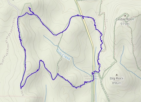
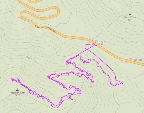
1.33 miles; 233-ft. total ascent; Mars Hill, NC

Yep, it’s Auntie. I apologize for the long LONG hiatus. In my defense, I spent most of last year moving from rental to rental, and then finally in August into my new house. But I also admit I’ve kind of just let things slide. An osteoporosis diagnosis and bears and several falls while hiking kind of put me in a “scared to hike” frame of mind. But I am now well-established in my new house and have gotten myself a personal trainer to help with strength and balance issues, so let me just tentatively say “I’m back, baby!”

“Maybe.”

On to today’s hike! This place is both a historical and hiking preservation effort by the local community, including both faculty and students of Mars Hill University. It’s got about 5-ish miles of trails that wind first through the Smith farm and then up the mountain. Due to my long hiatus, I was not in any shape to attempt to get to the summit, estimated to be about 1200-ft elevation, but lucky for me there is a small loop trail that climbs enough for now. This is the trail I took today.

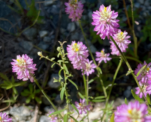
Early bloomers, top, Golden Ragwort (Packera aurea) buds. Bottom left, Common Violet (Viola sororia), and right, Spicebush flowers (Lindera benzoin).

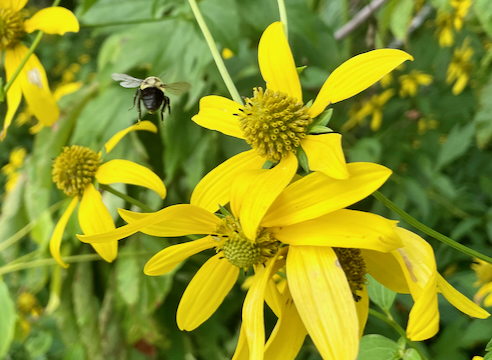
Even though it’s only the last week of March, there’re already plenty of wildflowers to be seen. Such a welcome sight at the end of winter!
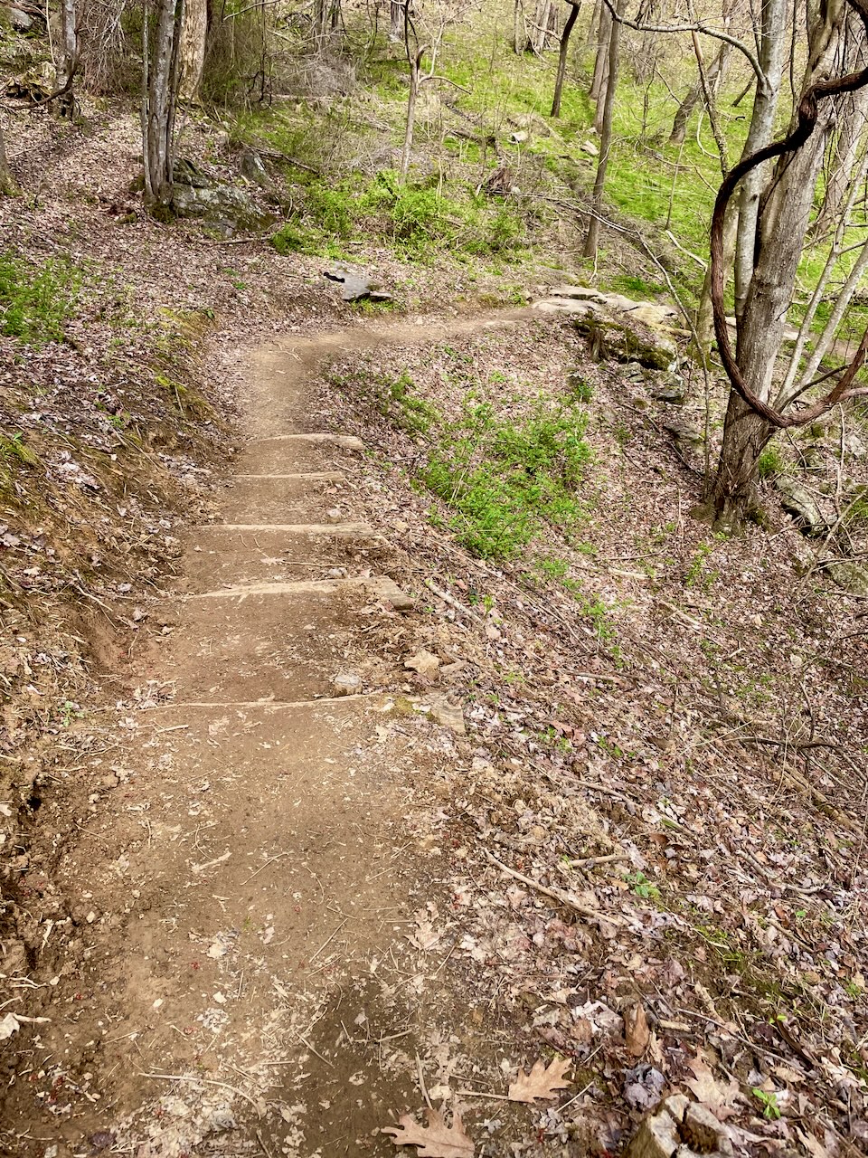
Gorgeous trailwork

Some of the earlier reviews on AllTrails for this preserve complain about the overgrown trails. Well, my experience (albeit only on this one short trail) was exactly the opposite. The trails here are gorgeous—thoughtfully placed and well-maintained. I had ZERO complaints. Furthermore, everything is very clearly marked. The Preserve is currently undergoing some construction at the farm, and even the detours are very clear and unambiguous. Ignore the bad reviews of years past, for sure!
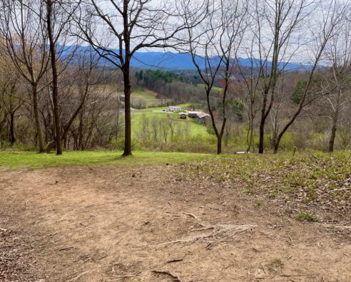
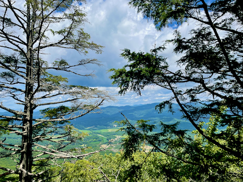
That view!

As you can see from this image, I didn’t get very far from the Smith Farm, but still had a wonderful view of the Blue Ridge Mountains.
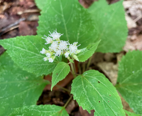
So many violets

Almost this entire walk was carpeted in violets. Pretty sure they’re all the same variety, Common Violets (Viola sororia).

You can find out more about Bailey Mountain Preserve from their website. As always, click the image above for details about this hike and to download the gps track. Note, this now opens in AllTrails. I think the mileage is just more accurate than in Gaia, which was my previous go-to.

Wilkie, Tower, and Twixt Trails, Dupont SF

Posted By on August 31, 2022

Wilkie, Tower, and Twixt Trails, Dupont SF

3.93 miles; 365-ft. total ascent; Cedar Mountain, NC

So if you read my last post about how I never get out into the woods unless it’s on a mushroom foray… Today I went hiking with my new friend (she of the Ferguson Peak trail). I’ve been wanting to go to the Dupont State Recreational Forest ever since, yes, a mushroom foray I went on there last year, and my friend indulged me.

Curtiss’s Milkwort (Polygala curtissii)

Saw these little beauties right at the parking lot. Dupont State Recreational Forest is a very popular and well-maintained forest with TONS of hiking trails and a lot of waterfalls, which are what draws the crowds. I’m not all that “destination-oriented,” and I just wanted to walk a nice loop in the woods. I think my friend picked these trails mostly because she liked the name “Twixt Trail.” Also, she had hiked here before and knew what to expect.

Signage

Love me some excellent signage, and Dupont doesn’t disappoint in that regard.

Rock outcroppings

These trails were kind of not what I’m used to seeing here in Western North Carolina. They were sandy, and there were granite outcroppings galore. You can tell from the shape that there is even a quarry nearby.

Wildlife!

My hiking companion spotted this little guy, I have no idea how. He blends in almost seamlessly.

Young “Old Man of the Woods” bolete (Strobilomyces strobilaceus)

This isn’t a mushroom walk so of course what caught my eye? ‘Shrooms! I am told this is variety is edible, but not particularly choice. I’ll pass, thanks.

Hypomyces completus parasitizing a Suillus spraguei mushroom

I noticed a lot of hypomyces fungus on this walk. Hypomyces is a fungus that parasitizes other mushrooms. The more famous Lobster mushroom is a kind of hypomyces. I’ve never tried it, but I’m told that the reason it’s called Lobster is that it tastes like lobster. Huh. This one, is alas, not that.

Yours truly


Cinnabar chanterelles (Cantharellus cinnabarinus)

At last! An action photo of me and Lambchop documenting our hike.

Black Trumpet JACKPOT!!!

Shortly after I took the photo of the cinnabar chanterelles, I hit the jackpot of a big, lush patch of black trumpet mushrooms. These are my favorite wild mushroom… well, except for hen-of-the-woods, but it’s too early for them down here in NC. I plan to dry them and grind them into a powder to make this recipe from the Three Foragers. Well, I will when I get my pasta maker back from storage in Connecticut. 🙁

You can find out more about the Dupont State Recreational Forest from their website. As always, click the image above for details about this hike and to download the gps track. Note, many of these photos courtesy of Jan Hines.

Big Butt Mushroom Walk

Posted By on August 25, 2022

Big Butt Mushroom Walk

1.1 miles; 131 ft. total ascent; Black Mountain, NC

Another day another mushroom walk. Seems like this is the only way I get out into the woods anymore. Gotta do something about that. Anyway… This is the other end of the Big Butt Trail wildflower walk I did back in May. [Imma refrain from the incessant rap lyric quotes of that last post, mercifully.]

Pipevine Swallowtail (Genus Battus)

It’s a mushroom walk, right? So what catches my attention? Wildlife! This guy has a survival strategy similar to that of the Monarch butterfly, in that it feeds exclusively on the highly poisonous pipevine plant, which, besides being poisonous is also quite nasty tasting (I am told). Many of its cousins mimic its appearance to take advantage of that strategy, too.

Atop Mount Mitchell

Weirdly I did not get ANY mushroom photos. But once the main part of the collecting was over, our group decamped from the Blue Ridge Parkway where this hike originated, because according to park rules, we are not allowed to collect ANY mushrooms here. And just so you don’t think we’re a bunch of fungal outlaws, we absolutely did not collect anything until we passed the BRP boundary along the western edge of the Big Tom Wilson Preserve. So technically we collected in the Pisgah National Forest. Which we are allowed to do. Honest.

Anyway, the place we went to for the ID portion of the program was Mount Mitchell State Park. Mount Mitchell is the highest peak east of the Mississippi, at 6,684 feet. They have a lovely little gift shop/cafe just below the peak at the parking area, and then you can continue up about another 300 yards along a paved trail to the actual peak.

Mushroom collecting kit


Identification

After we all get back and have a spot of lunch, we put all of our individual finds into these little paper boat things, and then folks more knowledgeable than I spend several hours poring through mushroom ID books and inspecting the finds in order to identify them, filling out little slips of paper.

ID’d mushrooms

And here’s what that looks like. At the end of the day, one person, usually the foray organizer, volunteers to collect all the little pieces of paper and enter them into an excel spreadsheet that includes the date and place the specimen was collected.

I will admit that I kind of just come on these walks to find new hiking places and hang with a fun[-gi] bunch of people, after which I usually just skedaddle home. But everyone keeps warning me that if I keep it up I’m likely to get hooked on ID’ing myself. Time will tell…

You can find out more about the Asheville Mushroom Club from their website. More info about the Big Tom Wilson Preserve here, and Mount Mitchell State Park here. As always, click the image above for details about this hike and to download the gps track.

Purchase Knob Mushroom Walk

Posted By on August 20, 2022

Purchase Knob Mushroom Walk

1.2 miles; 109 ft. total ascent; Waynesville, NC

This was another Asheville Mushroom Club excursion, and it wasn’t till I got here that I realized I’d hiked here before, back in June of 2020. Last time I had to make the loooong walk up the road from the gate, but because the club was doing a park-approved mushroom survey, we had the gate codes to drive right up to the top.

View from the Science Center lawn

And what a top! When I was here before I didn’t realize that the building at the summit was once a private residence. Can you imagine waking up to this every morning??? Absolutely stunning. This property is now part of the Great Smoky Mountains National Park, and you can see where they got the name.

Starry Campion (Silene stellata)


White Snakeroot (Ageratina altissima)

Being much better versed in wildflowers than in fungi, these caught my eye. It’s kind of approaching the end of the wildflower season up here (we were at about 5,000 feet elevation). But there was still plenty to see.

Heckuva lunch spot!

I was trying to figure out what mountains I was looking at here, so I tried using the Peakfinder app. That’s a pretty amazing thing… Here’s what I came up with.

Peakfinder screenshot

That tallest peak just visible through the vegetation on the right is Mount Pisgah. I had that confirmed by some of my fellow fungi enthusiasts.

Bumblebee butt!

I was joined during lunch by this lady, who really didn’t have time to visit, she was so busy collecting pollen and nectar. Wanna say the flowers are sochan, or cutleaf coneflower. In the early spring, the Cherokee collected this as a spring green. In fact, the Eastern Band still does; they’re the only ones permitted by the National Park Service to do so.

Puffballs-in-aspic (Calostoma cinnabarinum)

Oh, and right, it was, after all, a mushroom foray! These are just one of my favorites. They’re also know as gelatinous stalked-puffball. So cool.

You can find out more about the Asheville Mushroom Club from their website. You can find out more about the Appalachian Highlands Science Learning Center from their website. You can find out about the Peakfinder app from their website. And as always, click the image above for details about this hike and to download the gps track.

Gorges SP Mushroom Walk

Posted By on July 22, 2022

Gorges SP Mushroom Walk

1.71 miles; 184 ft. total ascent; Sapphire, NC

As you may or may not know, I am a member of the Asheville Mushroom Club (AMC—not to be confused with the Appalachian Mountain Club). The club sponsors walks or “forays” for club members, and creates species lists based on our finds. These species lists are sometimes why we get granted special permission to collect, as was the case here at Gorges State Park on the NC/SC border.

In fact, on this particular walk we were accompanied by a park ranger, who showed me something very interesting about the little guy below. When startled or threatened, they give off the aroma of Dr. Pepper. Who knew???

Wildlife!

You know, sooner or later I’m going to put up a “Wildllife!” photo of an actual bear. Western North Carolina is lousy with them. But that day is not today. This guy is part of a family of millipedes known as “flat-backed millipedes.”

Now I’m not a particularly STEM-oriented person, and don’t really participate in the ID process. Members who do bring boxes and boxes of books, and some folks even have little chemical kits that they use to positively identify species of fungi. And if that’s not enough to definitely ID particularly tough species, there are some members who bring the samples home to examine them under microscopes.

Example of an ID

I am told that the above species is quite edible, although the caps tend to get mushy when you cook them, the stems (or stipes) hold up well. This seems to me to be something I could even trust my own ID on. If I ever to find them, I’ll let you know how they taste.

View

No, the main reason I love joining in on these walks, aside from the excellent company, is that I get exposed to all kinds of cool places that I need to revisit for more hiking. Gorges [or Gorgeous, ammirite???] State Park is one of those places. It seems as if, looking at the maps, this place is full of great trails. Cannot wait.

You can find out more about the Asheville Mushroom Club from their website. For more information about Gorges State Park, see this page. As always, click the image above for details about this hike and to download the gps track.

Ferguson Peak Trail

Posted By on July 18, 2022

Ferguson Peak Trail

3.25 miles; 673 ft. total elevation gain; Gerton, NC

This was a very serendipitous hike, in that I met a new friend when I went to my volunteer gig at the Botanical Gardens at Asheville, and we hit it off so totally that we made a date to hike together.

Trail Marker

She took me to this short, steep trail in Hickory Nut Gap, part of a larger trail system created and maintained by the Southern Appalachian Highlands Conservancy.

Mountain Bunchflower

In between gasping for breath, and perhaps in order to catch my breath, I noticed this interesting green flower, the Mountain Bunchflower. This is a member of the lily family, endemic to the southern Appalachians, and highly poisonous. Good to know.

The Payoff

Yeah, this was the payoff for doing all that climbing. The view was spectacular. One might almost say breathtaking.

You can find out more about the Southern Appalachian Highlands Conservancy from their website, and more specificaSlly, you can read about the Strawberry Gap Trail here. As always, click the image above for details about this hike and to download the gps track.